Subject: Strait of Magellan
Period: 1753-90 (circa)
Publication:
Color: Black & White
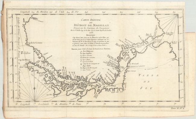
A. Carte Reduite du Detroit de Magellan Dressee sur les Journaux des Navigateurs, by Jacques Nicolas Bellin, dated 1753, (13.6 x 7.5"). This detailed chart of the Strait of Magellan locates harbors, islands, capes, and bays from Cap des Vierges to Cap de la Victoire. A lettered reference table is included below the title identifying anchorages, bays, and harbors in the vicinity of Isle de Louis le Grand at the mid-point of the strait. Condition: Issued folding on watermarked paper with a small binding trim in the top right blank margin.
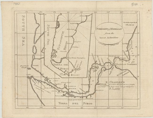
B. Streights of Magellan from the Latest Authorities, by Alexander Kincaid, from A New Geographical, Commercial, and Historical Grammar..., circa 1790 (8.9 x 7.0"). This uncommon map depicts the Strait of Magellan with soundings and interesting notes along the coast such as "Rocks like Asses ears" and "The land of desolation on which is perpetual Snow." An inset zooms out to show a broader view of Patagorum Regio and Terra del Fuego. Engraved by J. Fraser. Reference: McCorkle (18th C. Geography Books) #208-2. Condition: Issued folding on paper with a fleur-de-lis watermark. There is faint offsetting from an opposing page of text.
References:
Condition: A
See description above.