Subject: Martinique
Period: 1730 (circa)
Publication:
Color: Hand Color
Size:
23.1 x 20.1 inches
58.7 x 51.1 cm
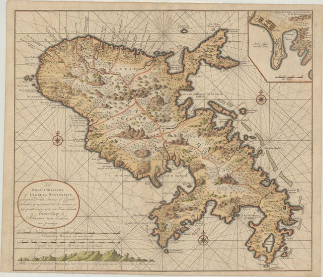
This is a rare sea chart of the island of Martinique showing mountains, roads, towns, forts, churches, anchorages and dozens of place names. Exhibiting fine coastal detail, the chart locates the major anchorages and navigational hazards. Inset at top is a plan of Fort Royal (Fort-de-France) showing the fortification and the nearby town. The chart is oriented with three compass roses and rhumb lines and a coastal approach view is engraved beneath the oval cartouche and two distance scales. Until the opening of the Dutch Hydrographic Office in the 19th century, the Van Keulen firm issued what were regarded as the official Dutch sea charts.
References:
Condition: A
A sharp impression printed on double thick paper. There is minor soiling at top center and the centerfold is reinforced on verso with light tissue at bottom.