Subject: Southwestern United States, Mexico & Central America
Period: 1824-35 (dated)
Publication:
Color: Hand Color
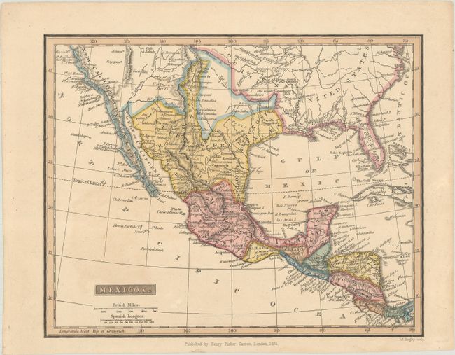
A. Mexico, &c., by Henry Fisher, dated 1824 (9.3 x 7.4"). Published in London just 3 years after the Mexican War of Independence, this small, rare map of Mexico features excellent detail of the political divisions, which were still in flux in the aftermath of the war. The Internal Provinces are still named despite dissolving in 1821. There is an unnamed area to the north of the Internal Provinces that would become Texas. New Mexico is just a narrow strip that includes Albuquerque, Santa Fe, and Taos. The Baja peninsula is labeled California, with New California to its north. To the west of New Mexico, there is an area labeled Unknown Parts and Apaches are noted. Prairies are noted in present-day Texas, south of the R. Colorado de Texas. Engraved by James Bingley. Condition: Minor toning.
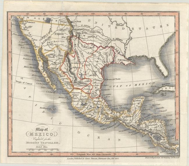
B. Map of Mexico, Engraved for the Modern Traveller, by Sidney Hall, from The Modern Traveller, dated 1825 (7.7 x 6.5"). This uncommon miniature map was published in the Mexico and Guatemala volume of Josiah Conder's The Modern Traveller. It details the political divisions, place names, and topography of Mexico. Present-day Texas is still part of Mexico, and California is here divided into Old California (Baja California) and New California, with its northern boundary around the San Francisco Bay. Drawn and engraved by Sidney Hall and published by James Duncan. Condition: Issued folding with some small abrasions in the map image at top. A binding trim at bottom right has been replaced with old paper.
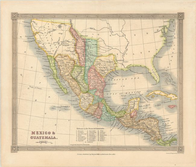
C. Mexico & Guatemala, by Alexander Findlay, from Barclay's English Dictionary, dated 1835 (9.6 x 7.8"). This nicely engraved small map was published around the time of the establishment of the Centralist Republic of Mexico in 1835. It delineates Mexican Texas. The area that would become New Mexico is divided into two unnnamed territories. The map shows all of Upper or New California naming San Francisco, Santa Barbara, San Diego, etc. The Baja peninsula is Lr. or Old California. The Great Salt Lake is located as Youta or Gr. Salt L. There are two conjectural courses of the R. Buenaventura connecting to the Pacific Ocean. A key at bottom identifies the 24 states of Guatemala. Published in London by Thomas Kelly. Condition: There is minor offsetting and marginal toning.
References:
Condition: A
See description above.