Subject: World, World War II
Period: 1942 (circa)
Publication:
Color: Printed Color
Size:
37.6 x 23.6 inches
95.5 x 59.9 cm
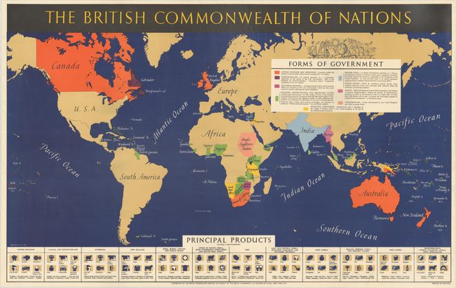
This interesting map was published by the British Information Services during World War II and focuses on the types of governments in the British Commonwealth of Nations throughout the world as well as the products and natural resources derived from these nations. A color-coded key identifies the forms of government, such as self-governing territories, central government, mandated territories, and condominiums. At bottom is a pictorial representation of the principal products from the Commonwealth of Nations, as well as a listing of additional products for each, including vehicles from the United Kingdom, wool from Australia, gold from Canada, and beer from Eire. This propaganda map was distributed by the British Information Services but issued from their office based in New York City. The British Commonwealth of Nations is a political association of sovereign states including the United Kingdom and former territories of the British Empire.
References:
Condition: A+
Clean and bright, issued folding, now flattened and backed in thin, archival tissue.


