Catalog Archive
Auction 184, Lot 35

Unusual World War II Army Map with Humorous Decorative Elements

"Legend All Distances in Nautical Air Miles Prepared by Operations Section Second Engineers January, 1942", U.S. Army

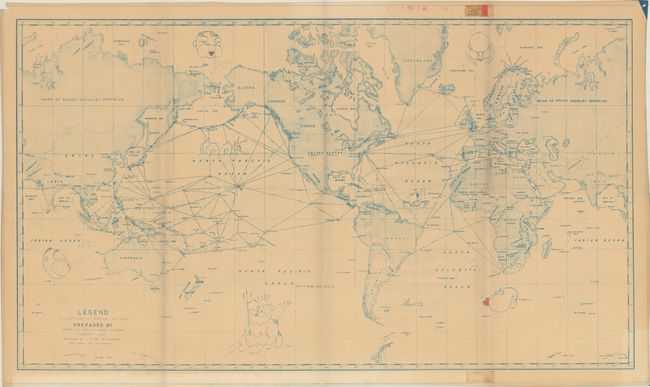
Subject: World, World War II

Period: 1942 (dated)

Publication:

Color: Printed Color

Size:
47 x 26.8 inches
119.4 x 68.1 cm
Download High Resolution Image
(or just click on image to launch the Zoom viewer)

This unusual world map was prepared by the Operations Section Second Engineers. Printed in blue ink, it is centered on the United States and shows the mileages between important ports, with an emphasis on the Pacific Ocean. The map incorporates a number of humorous renditions of classical decorative elements including four windheads, a sea serpent in the North Pacific, an old ship in the North Atlantic, a whale in the South Atlantic, and a large Poseidon with his trident in the South Pacific. Drafted by PFC R. M. Harris and supervised by Lt. B. K. Weatherwax. There are no past sales records or institutional copies located on OCLC.

References:

Condition: B

Issued folding with light toning and a manuscript note at lower center. There are pinholes in the corners and minor staining in the top and bottom blank margins.

Estimate: $200 - $250

Sold for: $210

Closed on 9/15/2021

Archived