Subject: Yosemite, California
Period: 1903 (published)
Publication:
Color: Printed Color
Size:
5.8 x 9 inches
14.7 x 22.9 cm
Three maps of Yosemite National Park are included in the superintendent's 21-page annual report:
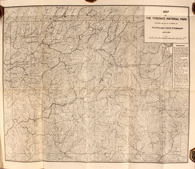
A. Map of the Yosemite National Park Prepared for Use of U.S. Troops by N.F. McClure, 1st Lieut., 5th Cavalry, by U.S. Army, dated 1896, black & white (19.9 x 16.3"). This very detailed and important map was made shortly after the establishment of Yosemite as a protected park in 1890. During this period, the Army's Fifth Cavalry Regiment controlled the park, and this map was made for their use. The map is filled with information on trails, cabins, camps and meticulous notes on topography.
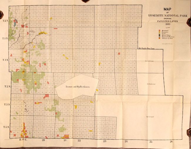
B. Map of Yosemite National Park Showing Patented Lands, by U.S. Government, dated 1903, printed color (34.0 x 25.1"). Centered on the Yosemite and Big Tree Grants, the map is color-coded to identify Homesteads, Preemption, Timber, Mineral Claims and more. A large region south of the Mt. Diablo Base Line is marked "Not Subdivided" and "Not Surveyed." Lithographed by The Norris Peters Co.
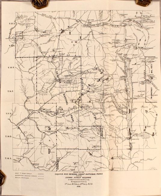
C. Sketch of the Sequoia and General Grant National Parks and the Sierra Forest Reserve, by 2nd Lieut. M.F. Davis, dated 1896, black & white (12.8 x 14.2"). This map presents good detail of the Sierra Forest Reserve (including Sequoia National Park) and surrounding region. Identifies roads, trails, camps, lakes, rivers, mountain peaks, and more. Locates the Mt. Whitney Military Reservation at right.
The disbound report and maps are housed in archival paper covers.
References:
Condition: A
Maps are clean, bright and near fine. Disbound text is mostly clean and separated into two sections.