Catalog Archive
Auction 184, Lot 238

"[Map with Report] Map Exhibiting the Routes Between Fort Dalles and the Great Salt Lake... [with] Report of the Secretary of War ... Report of Captain H.D. Wallen of His Expedition, in 1859, from Dalles City to Great Salt Lake, and Back", U.S. War Department

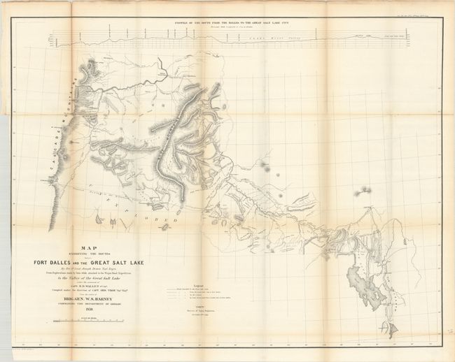
Subject: Western United States

Period: 1860 (published)

Publication: Sen. Ex. Doc. 34, 36th Congress, 1st Session

Color: Black & White

Size:
33 x 25.7 inches
83.8 x 65.3 cm
Download High Resolution Image
(or just click on image to launch the Zoom viewer)

Captain H.D. Wallen's detailed wagon road map extends from Camp Floyd adjacent to Lake Utah all the way to the Cascade Range and Mt. Adams. Locates Fort Boise, Fort Walla Walla, Salt Lake City, Fort Hall, and Fremont's Route in 1843. Topography is shown via hachure with excellent detail along the route. This is the November 9th, 1860 edition drawn by Joseph Dixon of the Topographical Engineers. Accompanied by Wallen's 51-page report. Disbound and housed in archival paper covers with handwritten label.

References: Wheat (TMW) #972.

Condition: B+

The folding map has light toning along the folds, several small splits at the fold junctions, and a binding trim at left that cuts into the border at lower left. Disbound text is clean and bright.

Estimate: $160 - $190

Sold for: $120

Closed on 9/15/2021

Archived