Catalog Archive
Auction 184, Lot 193

"Carte de la Nouvelle Angleterre, Nouvelle York, Nouvelle Jersey, et Pensilvanie", Laporte, Joseph de
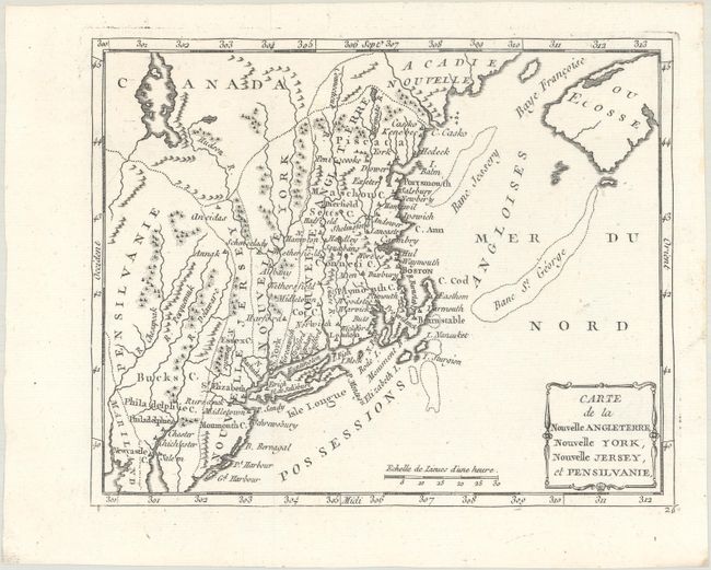
Subject: Colonial New England & Mid-Atlantic United States

Period: 1780 (circa)

Publication: Atlas Moderne Portatif…

Color: Black & White

Size:
8.8 x 7 inches
22.4 x 17.8 cm
Download High Resolution Image
(or just click on image to launch the Zoom viewer)

This uncommon and small Revolutionary War-era map features odd boundaries. Pennsylvania, New Jersey, New York, and Nouvelle Angleterre all appear as an amorphous strip stretching north-south, reflecting France's lack of knowledge of colonial boundaries. The Susquehanna River is called the Chesapeake, and the Schuylkill River is called the Perquemuk. This map is from the original plate, which is much less common than the later variant with Etats-Unis replacing Possessions Angloises in the Atlantic.

References:

Condition: A

Issued folding on a clean bright sheet of watermarked paper with one tiny hole in an unengraved area that has been professionally infilled on verso.

Estimate: $250 - $325

Unsold

Closed on 9/15/2021

Archived