Subject: North America
Period: 1790-98 (circa)
Publication:
Color: Hand Color
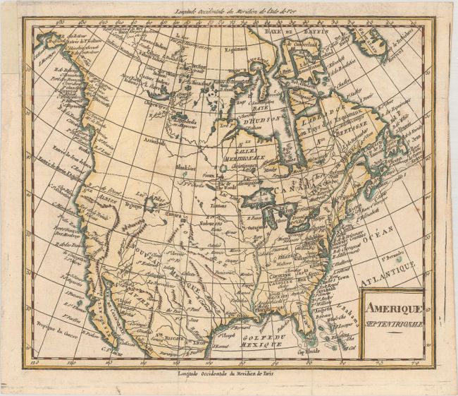
A. Amerique Septentrionale, by Anonymous, circa 1790 (8.6 x 7.3"). This copper engraved French map shows the young United States with some fascinating features. The southern states stretch to the Mississippi, with the land to the west divided into Louisiane, Nouveau Mexique, and Nle Albion. The boundary to the Spanish territories extends all the way to the Strait of Juan de Fuca in the Pacific Northwest. A large Lac Pikes (no relation to Zebulon Pike) appears in the west in an area labeled Teguayo et Quivira with a conjectural R d l'Ouest extending to Entree de Martin d'Aguilar. Although Alaska is not shown in its entirety, Cook's Inlet is identified with the name R. de Cook. The discoveries of Mackenzie and Hearne are noted in Canada. Condition: Issued folding, now flat, with some small wormholes that have been backed on verso with archival material. A binding trim at top left has been replaced with archival tissue. (B+)
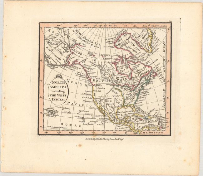
B. North America, Including the West Indies, by William Faden, from Atlas Minimus Universalis, dated 1798 (4.7 x 4.0"). This scarce and interesting miniature map notes the Sea of the West near the Strait of Juan de Fuca. Quivira and Teguayo are both named in the west, and the West Coast is labeled New Albion. The United States is confined to the east of the Mississippi, with Spanish Louisiana and New Mexico identified to its west. Curiously, only three states are named - New York, Rhode Island, and Kentucky - although there are major cities and bays named along the East Coast. A note at the end of the Mississippi and Missouri rivers indicates "Sources unknown." The Sandwich Isles are located. The Alaska Peninsula is named, and the map extends to show Asia on the other side of the Bering Strait. Engraved by John Hatchett. References: King (miniaturemaps.net) #1798a Faden; McGuirk #230. Condition: A sharp impression on paper with a "J. Whatman 178-" watermark. There is one small spot of foxing along the bottom border. (A)
References:
Condition:
See description above.


