Subject: Quebec, Canada
Period: 1733 (circa)
Publication:
Color: Hand Color
Size:
26.8 x 19.2 inches
68.1 x 48.8 cm
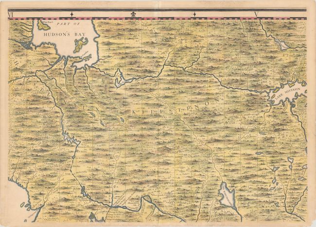
This is sheet 2 of Popple's 20-sheet map of the British Empire in North America, covering the region between the Great Lakes and Hudson Bay. It spans from James Bay and the Michipocten Bay in the west to Lake Mistasin (Lake Mistassini) in Quebec. The first three Hudson's Bay Company posts in North America, Fort Rupert, Fort Saint Louis (Moose Factory), and Fort Saint Anne (Fort Albany), are identified around James Bay. Charlton Island and part of Akimiski Island (named White Bear I., likely for its polar bears) are located in James Bay. A Habitation Europeane is noted near Lake Mistassini. The map is filled with nice topographical detail. Popple made use of both English and French maps as sources, including Delisle and De Fer.
Popple based his map on firsthand information gathered over several years at the Board of Trade and Plantations. The map was the first large-scale British map to provide an overall view of the eastern half of North America. As tensions grew between the colonial powers, the map became immensely influential throughout Europe and was copied by several cartographers. This is an early state with no page number.
References: Pritchard & Taliaferro #24.
Condition: B+
A sharp impression on a sheet with a coat of arms watermark and light toning along the edges. Several small chips and tears along the bottom edge have been partially repaired on verso. Centerfold separations at top and bottom and a tiny split to the left of the centerfold have been archivally repaired on verso.