Subject: Indian Ocean
Period: 1757 (dated)
Publication:
Color: Black & White
Size:
34.6 x 21.9 inches
87.9 x 55.6 cm
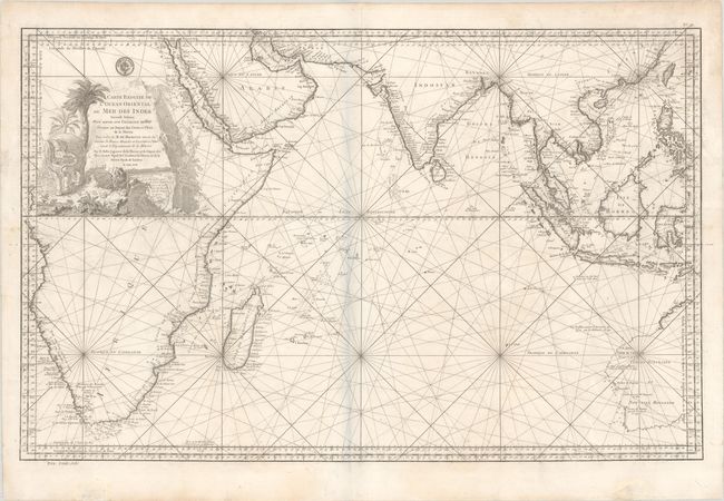
This large-scale sea chart covers southern Asia and the Indian Ocean, extending from Africa through the Philippines and western Australia. Originally published in 1740, this is Bellin's second edition, with significant updates to the cartography. The map provides great detail of the islands and coastlines. Cape Town is located. A note on the western coast of Africa notes that the stretch of land between Cape Frio and Cape Voltas is a mystery. Various discoveries are noted on the tentative coastline of western Australia. The chart is crisscrossed by rhumb lines, and there is a large and attractive title cartouche at top left with an elephant, a lion, and a crocodile. This example has the seal of the Depot de la Marine above the cartouche and a price of "trente sols" below the neatline at left.
References: Norwich #280.
Condition: B+
On a sheet with a large coat of arms watermark and professional repairs to a chip in the title cartouche and three edge tears which enter the map image, the longest measuring 3.5".