Catalog Archive
Auction 183, Lot 440

"Rei Romanae Tabula Geographica ex C.I. Caesaris Commentarijs de Bello Civili", Duval, Pierre

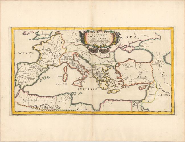
Subject: Mediterranean, Roman Empire

Period: 1666 (dated)

Publication:

Color: Hand Color

Size:
22.1 x 11.9 inches
56.1 x 30.2 cm
Download High Resolution Image
(or just click on image to launch the Zoom viewer)

This map shows the Roman Empire surrounding the Mediterranean Sea, noting ancient place names and illustrating the major river systems. Adorned with a decorative title cartouche and published by Pierre Mariette.

References:

Condition: A

A sharp impression with contemporary outline color and later color in the cartouche, on a bright sheet with a large coat of arms watermark. There are a couple of small spots in the image and a few minor extraneous creases adjacent to the centerfold.

Estimate: $200 - $230

Sold for: $150

Closed on 6/9/2021

Archived