Subject: France
Period: 1698 (dated)
Publication:
Color: Hand Color
Size:
23.5 x 17.6 inches
59.7 x 44.7 cm
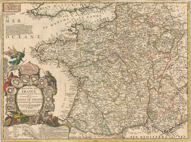
This detailed and decorative map of France is divided into provinces and is dedicated to King Louis XIV. A legend identifies archbishoprics, universities, parliament, chambers of commerce, and more. Adjacent to the legend is an inset map of the route between Rouen and Paris along with a note explaining the difference between astronomical measurements of distance and actual traveling distances, which are typically longer. Another note at top left explains that a more detailed four-sheet map of France and a book on the geography of France, both by Tillemon, can be purchased at Nolin's shop. The superb title cartouche is surrounded by bird's-eye plans of Paris, Strasburg, Lille, and eight other cities, as well as several allegorical figures, including the angel of Fame and a pair of chained men.
References:
Condition: B
A nice impression with contemporary outline color in the map and later color in the cartouche, on watermarked paper with light soiling and a long centerfold separation that has been archivally repaired. Trimmed to the neatline with loss of neatline in some spots.