Subject: Western Belgium
Period: 1571 (published)
Publication: Theatrum Orbis Terrarum
Color: Hand Color
Size:
19.7 x 15.1 inches
50 x 38.4 cm
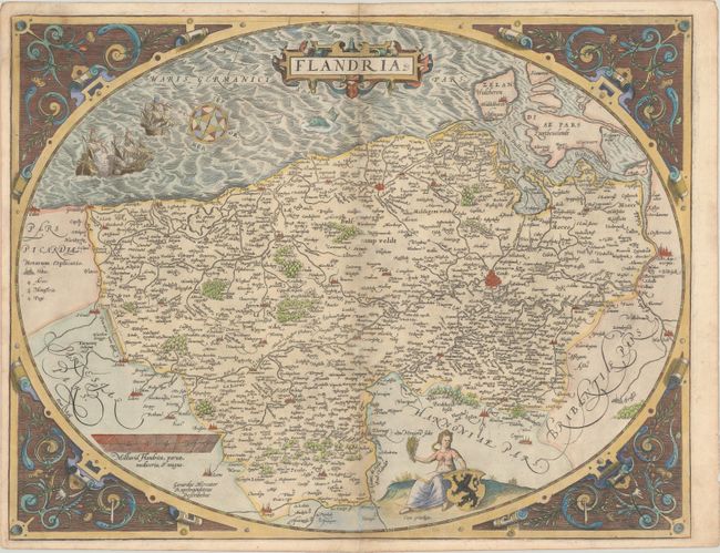
This is the rare, first of three plates of Flanders that Ortelius published in his monumental Theatrum Orbis Terrarum. The map extends from Zeeland and Antwerp in the north to Calais in the south, and as far east as Douai and Brussels. Rivers, forests, political boundaries, and hundreds of towns are shown, with the largest cities marked with miniature bird's eye views. The map is embellished with galleons engaged in battle, a sea monster, and an allegorical female figure holding a bundle of grains and the coat of arms of Flanders. The map is enclosed in an elegantly engraved egg-shaped border. Latin text on verso.
References: Van den Broecke #75.
Condition: B+
Gilt highlights on paper with the crossed arrows watermark commonly found on Ortelius maps. There is minor toning along the centerfold, light soiling, and an archivally repaired tear at top left. The margins are a bit narrow, as issued, but still ample for framing.