Subject: Mount Rainier, Washington
Period: 1899-1909 (dated)
Publication:
Color: Printed Color
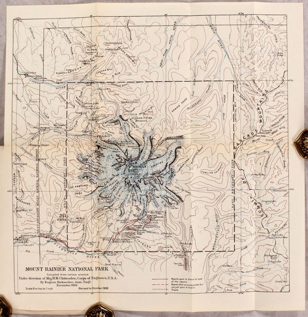
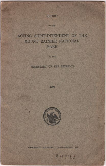
A. Mount Rainier National Park [in] Report of the Acting Superintendent of the Mount Rainier National Park to the Secretary of the Interior, by U.S. Department of the Interior, published 1909 (14.9 x 14.9"). An early map of Mount Rainer Park that was drawn by Eugene Ricksecker under the direction of Major H.M. Chittenden, Corps of Engineers. It depicts the numerous glaciers surrounding Mount Rainer including Emmons, Nisqually, and Tahoma to name a few. Includes good detail of open roads, projected roads, trails, numerous falls, and park hotel. Elevation is represented by contour lines. Originally issued in November 1906 and revised to October 1908. Mount Rainer was the fourth National Park in the United States, created in 1899. Ten years after its creation, the park welcomed 3,782 visitors and 346 automobiles. The report provides a detailed summary of the park’s operations and new rules and regulations, including for the admission of automobiles. The owner of one hotel is taken to task for operating with “an entire disregard for appearances. It has been inclosed by a wire fence….The buildings are very rough, and the fence is hung with signs and advertisements. One of the most objectional features is a board shanty used as a pool room…in a conspicuous place close to the road.” Condition: Folding map is clean and bright with one split at a fold junction. Report text is lightly toned and wrappers have minor soil. (B+)
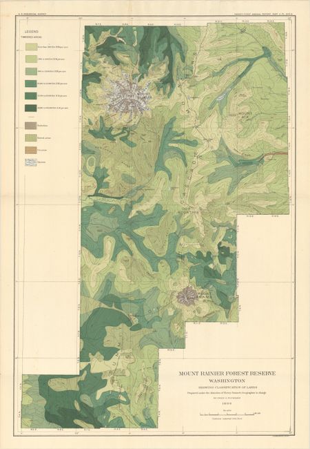
B. Mount Rainier Forest Reserve Washington Showing Classification of Lands Prepared Under the Direction Henry Gannett, by U.S. Geological Survey (USGS), from U.S. Geological Survey Twenty-First Annual Report Part V, dated 1899 (15.8 x 23.5"). This colorful map of Mount Rainer extends to include Mount Adams in the south and Mount Aix in the east. It is color-coded to show glaciers and the density of timbered areas as well as hatching for burned and cut areas. Compiled by Fred G. Plummer for whom Plummer Peak at Mount Rainer is named. Condition: A colorful example, issued folding. (A)
References:
Condition:
See description above.