Subject: Lake Tahoe, California
Period: 1927-30 (circa)
Publication:
Color: Black & White
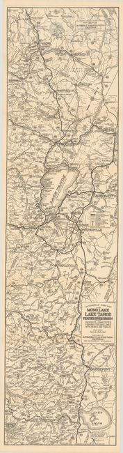
A. Automobile Road Map from Mono Lake to Lake Tahoe and Feather River Region Showing Resorts, Camp Sites, Fishing Streams, Lakes, Mtn. Peaks, and Trails, circa 1930 (8.4 x 32.9"). This detailed map extends from Yosemite and Mono Lake north to Lake Tahoe and Reno, emphasizing the evolving road network. The legend identifies useful information to both the traveler and tourist including highways, automobile roads, "other" roads, trails, campsites, mines, and fishing areas. The figures in circles represent mileage from Bridgeport (just north of Mono Lake). Self-folding (4.9 x 9.4"). Condition: Fine. (A+)
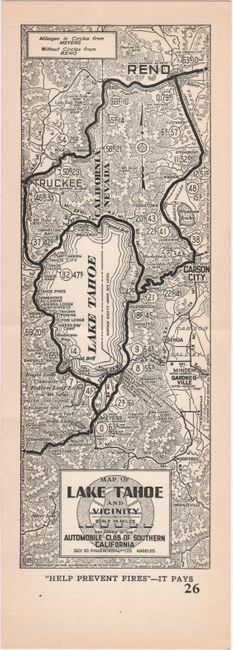
B. Map of Lake Tahoe and Vicinity, circa 1927 (3.1 x 8.8"). This map card shows the vicinity of Lake Tahoe, extending north to Truckee and Reno and east to Carson City. The circled figures show mileage from Meyers Hotel & Garage on the south side of Lake Tahoe. Condition: Light toning along the sheet edges. (A)
References:
Condition:
See description above.