Subject: Arizona
Period: 1881-87 (circa)
Publication:
Color:
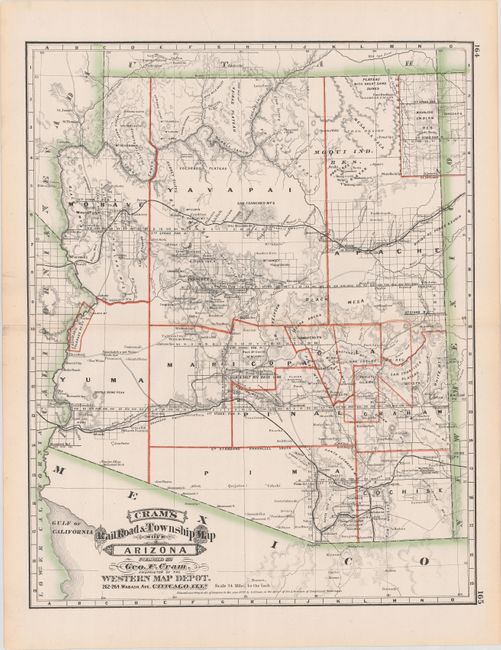
A. Cram's Rail Road & Township Map of Arizona, by George F. Cram, circa 1881, hand color (15.7 x 19.7"). While copyright dated 1879, this map of Arizona was published sometime after 1881 with 10 counties depicted. Surveying is limited to the regions along the two major railroad lines and in the vicinity of Prescott. The map locates towns, settlements, forts, camps, mines and more. Published by Cram at the Western Map Depot on Wabash Avenue. Condition: Clean and bright with a short fold separation at bottom that has been closed on verso with archival tape. (A)
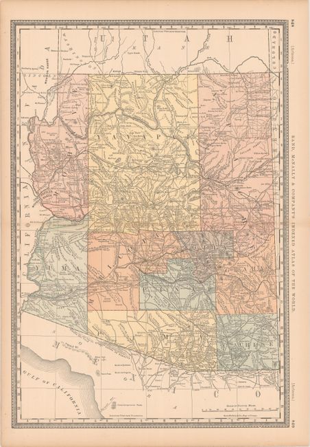
B. Arizona, by Rand, McNally & Company, from Rand, McNally & Company's Indexed Atlas of the World, circa 1887, printed color (13.3 x 19.3"). This double-page map of the state also delineates 10 counties and is rich with information including railroads, settlements, topography and drainage. Particularly noteworthy are the numerous roads in the state not seen on any other commercial maps of this period. Condition: Pleasant light toning. (B+)
References:
Condition:
See description above.