Subject: Iowa & Wisconsin
Period: 1838 (dated)
Publication: A General Atlas of the World
Color: Hand Color
Size:
11.4 x 14.3 inches
29 x 36.3 cm
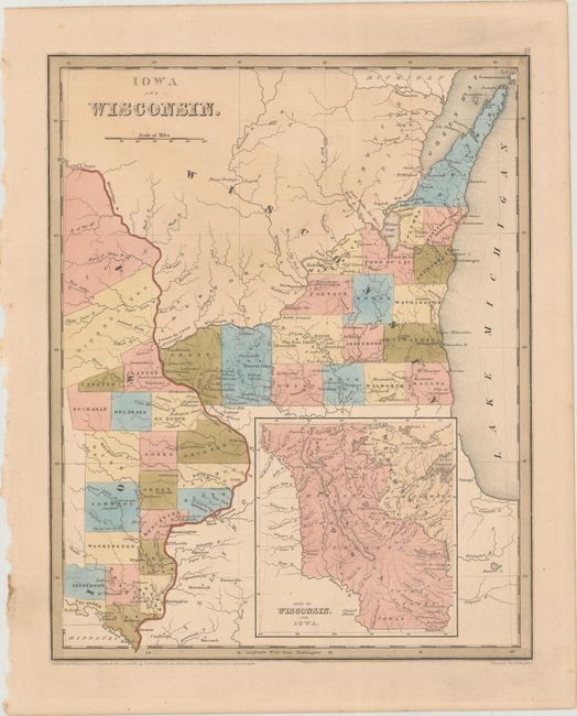
A scarce, early copper-engraved map that also includes part of today's Minnesota. The map extends from Missouri's northern border to Lake Pepin and east to the middle of Lake Michigan. There are 20 named counties along the Mississippi River in Iowa, suggesting the map was published circa 1841. The northern portion of Iowa Territory contains Sioux and Winnebago lands, while Wisconsin is largely unsettled with only 18 counties named in the southeastern part of the state. The large inset, based on Nicollet, details the lands of the Dahcota or Sioux, Chippeways, Fox, Iowa, and Saulk Indians, and the watershed of the Missouri and Mississippi Rivers. This map is among one of the first wave of detailed maps of these territories to appear in commercial atlases. Engraved by G.W. Boynton.
References:
Condition: A
Original color with a hint of pleasant light toning.