Subject: Western Hemisphere - America
Period: 1763 (circa)
Publication:
Color: Black & White
Size:
10.8 x 13.7 inches
27.4 x 34.8 cm
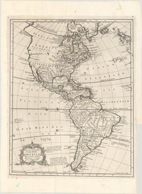
This uncommon Italian map of the Americas features several notes about exploration, including mentions of the discoveries of Davis and Anson. The Fiume d'Occidente (River of the West) is depicted flowing from an unnamed lake (perhaps Lake Winnipeg) to Cape Blanco. Nuovo Albione appears on the West Coast, and the northwestern portion of the continent is labeled Parti non Scoperte (or "undiscovered areas"). To the west of Luisiana is Nuovo Messico in present-day Texas. For some reason, Fort Rosalie appears west of New Orleans. There are numerous place names and Indian tribes identified throughout the map. The mythical Laguna de Xarayes is located in the middle of South America. Engraved by Andrea Scacciati. The map originally appeared in Gazzettiere Americano (1763) and was later published in Atlante dell' America (1777).
References:
Condition: A
A nice impression issued folding, now flat, with a binding trim and associated tiny tear confined to the right blank margin.