Subject: Northern Africa
Period: 1595-98 (published)
Publication:
Color: Black & White
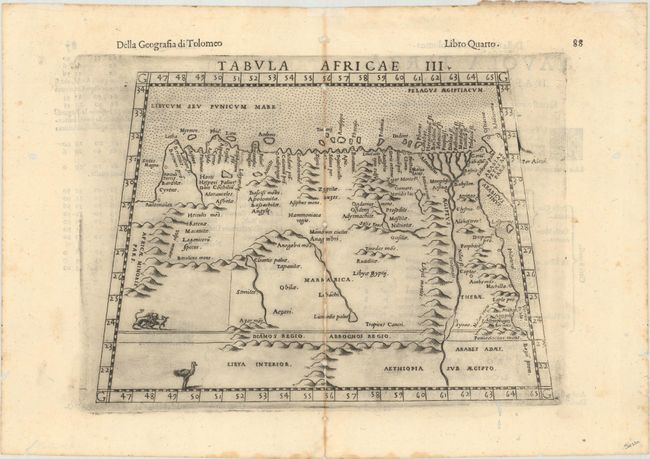
A. Tabula Africae III, by Ptolemy/Ruscelli, from La Geografia di Claudio Tolomeo Alessandrino…, published 1598 (9.8 x 6.9"). Finely engraved Ptolemaic map of eastern Libya and Egypt with numerous ancient place names. Depicts the course of the Nile River beyond Aswan in southern Egypt. The interior is filled with mountains as well as some spurious lakes and rivers. Drawn on a trapezoidal projection with a stippled sea. This is a later edition with the addition of an ostrich and a pair of lions. Italian text on verso. Reference: Mickwitz & Miekkavaara #227-13. Condition: A dark impression on a bright sheet with toning along the centerfold. There are worm tracks along the centerfold that have been archivally repaired, as well as small worm holes in the blank margins.
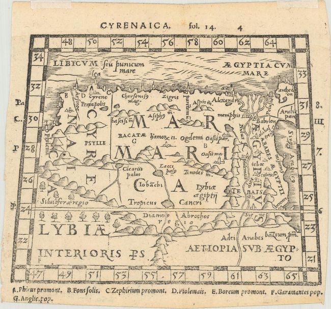
B. Cyrenaica, by Pomponius Mela, from Pomponii Melae De Orbis Situ Libri III, published 1595 (6.0 x 4.8"). An uncommon miniature woodblock map that was published in Mela's Pomponii Melae De Orbis Situ Libri III, with maps prepared by Heinrich Petri. It depicts northeastern Africa including Libya and Egypt, and features convoluted mountain ranges and large lakes as is typical for the maps of this time period. Includes large latitudinal and longitudinal scales along with a key at bottom. Reference: Shirley (BL Atlases) G.MELA-1c #4. Condition: A few faint spots in the image with trimmed margins and small remnants of hinge tape along the top edge of the sheet on recto.
References:
Condition: B+
See description above.