Subject: Japan & Korea
Period: 1946 (dated)
Publication:
Color: Printed Color
Size:
9.3 x 12.6 inches
23.6 x 32 cm
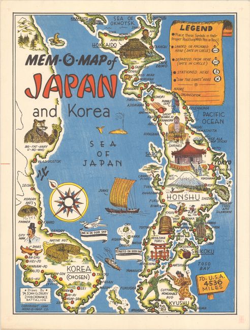
This colorful and deliberately lighthearted map of Japan and Korea was created for American servicemen returning to the USA after their tour of duty at the end of WWII. The map was conceived of and drawn by John Gottlieb Drury, who served two years as a 4th Grade Technician in the 214th Ordnance Battalion in the Pacific Theater during the war. The imagery on the map focuses on cultural and historical vignettes rather than reminders of the war. The intent for the map was for servicemen to commemorate their tour by marking their place of landing and departure, their route, and locations where they were stationed. Drury created five Mem-O-Maps just after the war, including ones for Okinawa, the Philippine Islands, Europe, and Oahu, Hawaii.
References: Curtis & Pedersen (War Map) pp. 216-219; Rumsey #9914.
Condition: A+
A superb example.