Subject: Persia - Iran
Period: 1750-70 (circa)
Publication:
Color: Hand Color
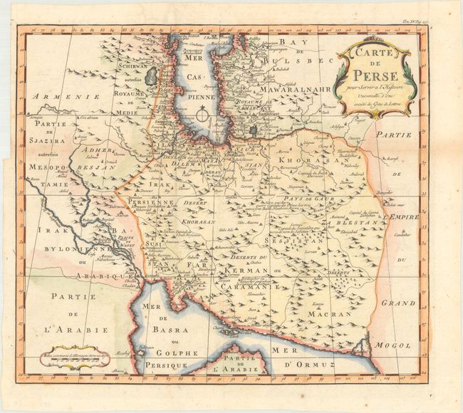
A. Carte de Perse pour Servir a l'Histoire Universelle, d'une Societe de Gens de Lettres, by Anton Francois Prevost, circa 1770 (14.5 x 12.6"). This attractive French map covers the Persian Empire. It shows the regional divisions and is filled with place names and explanatory notations. Condition: A sharp impression issued folding with a small wormhole in the Gulf of Oman, a tiny worm track near the center of the image, and some minor scattered foxing. There is a binding trim in the left blank margin.
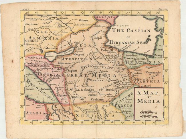
B. A Map of Media, by Anonymous, circa 1750 (10.8 x 8.3"). This handsome map centers on the historical region of Media in present-day northern Iran and Azerbaijan. It names nearby historical regions including Armenia, Assyria, Mesopotamia, Babylonia, Parthia, and Hyrcania. There is nice topographical detail, especially of the region's rivers and mountains. "Vol. III." and "Page 223" appear above the neatline. Condition: A crisp impression issued folding with a an archivally repaired fold separation that enters 0.5" into the map image at top. There is light scattered foxing concentrated in the title cartouche and blank margins.
References:
Condition: B+
See description above.