Subject: Persia - Iran
Period: 1678-1700 (circa)
Publication:
Color: Hand Color
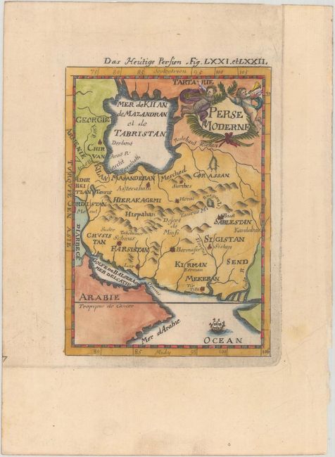
A. Perse Moderne, by Alain Manesson Mallet, from Beschreibung des Gantzen Welt-Kreisses, published 1685 (3.9 x 5.5"). This handsome miniature map of Persia stretches from Mosul to the Indus River. It names historical regions and some cities. A mountain range identified as the Taurus Mountains (likely the Zagros Mountains) spans the region from east to west. The Caspian Sea appears in a squat configuration and is labeled Mer de Kiian de Mazandran el de Tabristan. The map is decorated with a sailing ship in the Arabian Sea and a title cartouche featuring two putti and a garland at top right. Reference: Pastoureau, MANESSON-MALLET I B. Condition: There is a printer's crease and remnants of hinge tape on verso. (A)
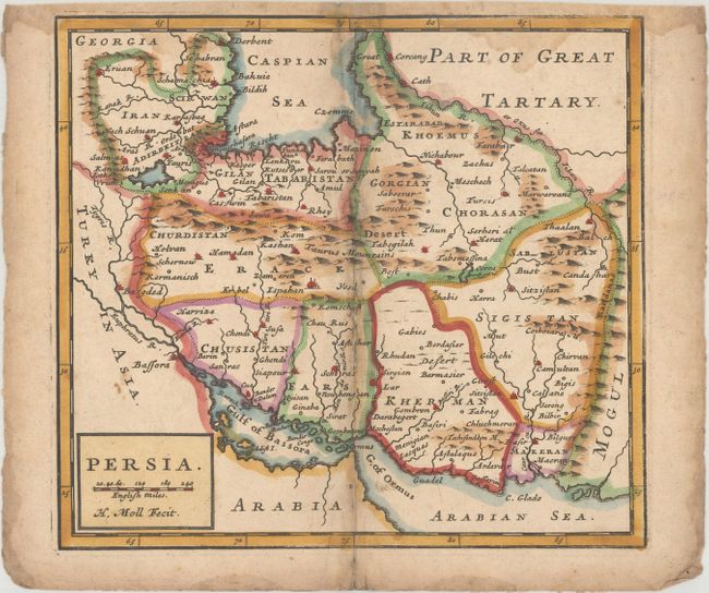
B. Persia, by Herman Moll, circa 1700 (7.5 x 6.8"). This small map of Persia is engraved in Moll's distinctive style. It spans from the Tigris River to Kandahar and divides the area into historical regions. There are plenty of place names and some nice topographical detail. Condition: There are light dampstains that enter the map image at top, light soiling, and some small holes along the centerfold that have been closed with archival materials on verso. (B)
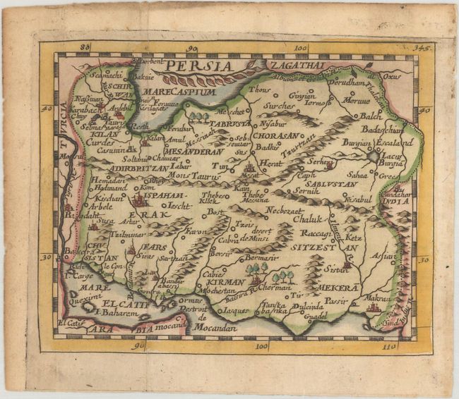
C. Persia, by Pierre Duval, from Geographiae Universalis, circa 1678 (5.0 x 4.0"). This miniature map of Persia depicts major towns and key topographical features. The Persian Gulf is named Mer El Catif, named for the city of Al-Qatif on the Arabian Peninsula that was the major trade port of the region. Pierre Duval was Nicolas Sanson's nephew and pupil. He published a wide range of atlases and individual maps including a fine miniature world geography with many of the maps based on Sanson. This map is from the rare German edition of Duval's world geography. The maps were probably engraved by Sigismund G. Hipschman (as his signature appears on the title page and the world map) and have Latin titles rather than the original French. The maps are often attributed to Johann C. Beer, who translated the work into German, and Johann Hoffman, who published Geographiae Universalis. Reference: King (2nd ed) pp. 144-145. Condition: Issued folding with marginal soiling. (A)
References:
Condition:
See description above.