Subject: Persia - Iran
Period: 1548-74 (published)
Publication:
Color: Black & White
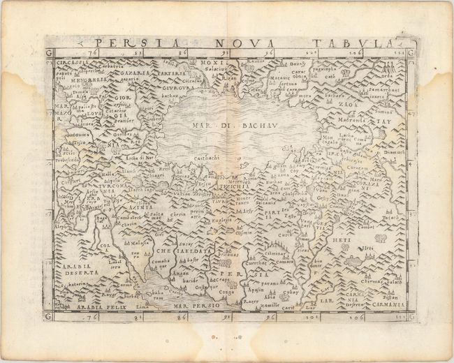
A. Persia Nova Tabula, by Giacomo Gastaldi, from La Geografia di Claudio Ptolemeo Alessandrino, published 1548 (6.8 x 4.9"). This is the earliest available modern map of Persia. It depicts the empire as it was during the time of the Safavid dynasty. There are plenty of place names and nice topographical detail. The Caspian Sea is here called Mar di Bachau and appears in a horizontal orientation typical of the era. Italian text on verso.
With maps engraved on copper, Gastaldi's work was conceived as the first "pocket" or miniature atlas. His monumental work was the most comprehensive atlas produced between Waldseemuller's Geographiae of 1513 and Ortelius' Theatrum of 1570. Condition: There are light dampstains at left and right and a couple pairs of wormholes in the map image.
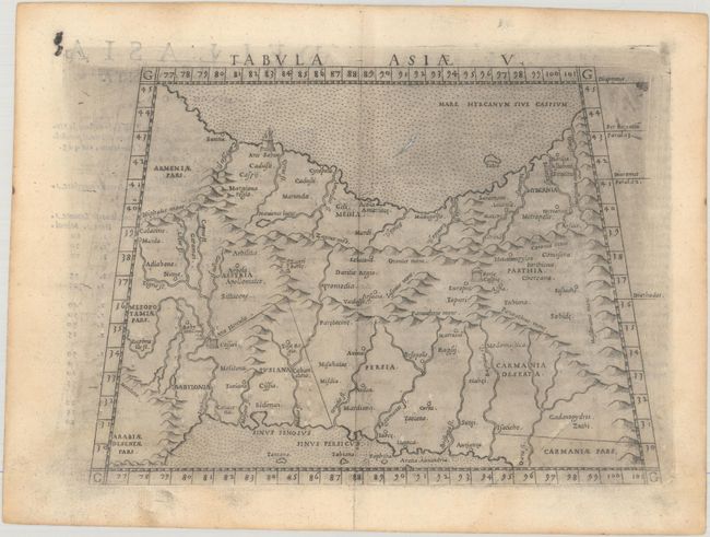
B. Tabula Asiae V, by Ptolemy/Ruscelli, from La Geografia di Claudio Tolomeo Alessandrino..., published 1574 (9.8 x 7.1"). Ptolemaic map of the region between the Persian Gulf and the Caspian Sea showing Babylon and Mesopotamia as well as other ancient empires. Important sites described by Strabo are noted including Arae Herculis, Arae Sabae, Zagri Portae,and Portae Caspie. Italian text on verso. Condition: There are light dampstains at bottom, a couple tiny pairs of wormholes in the map image, and printer's ink residue.
References: Mickwitz & Miekkavaara #214-43 & #220-20.
Condition: B+
See description above.