Subject: Mediterranean
Period: 1764 (dated)
Publication:
Color:
Size:
8.1 x 5.3 inches
20.6 x 13.5 cm
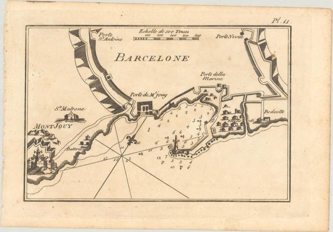
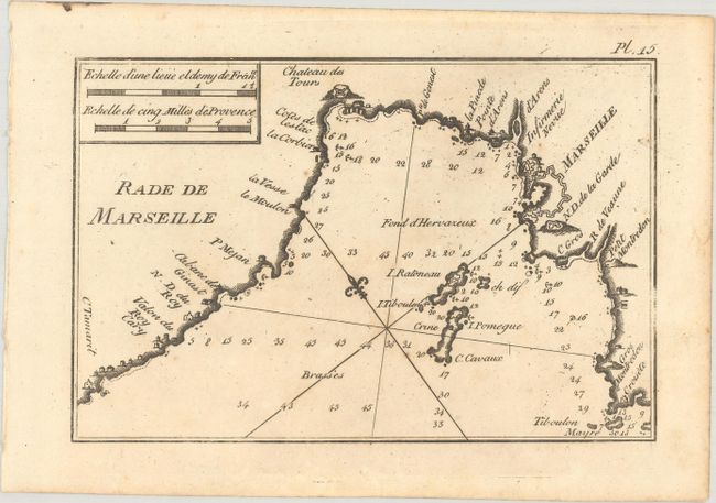
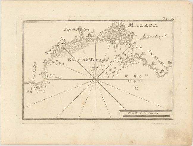
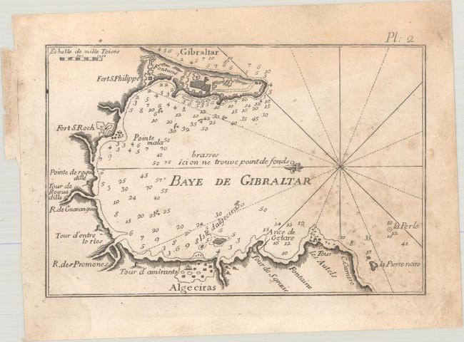
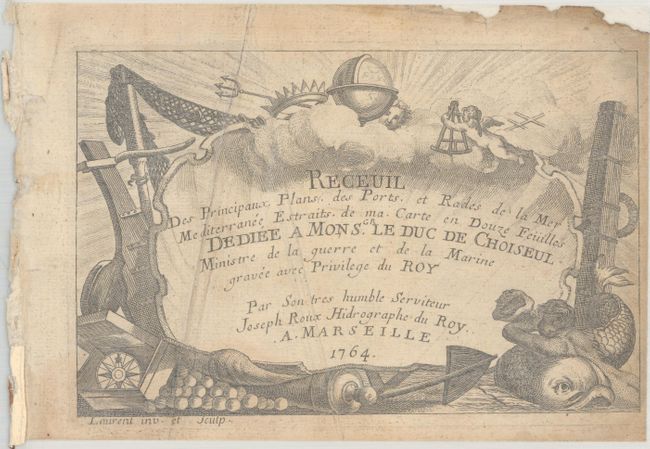
This lot includes 33 plans from Roux' atlas of ports and harbors around the Mediterranean. Roux' atlas was first published in 1764, with updated editions published through 1874. The plans in this lot are from multiple editions and include Barcelona, Gibraltar, Malaga, Alacante, Cette, Marseille, Tripoli, and many more. These fabulous plans detail the various towns and cities in their fortifications, chateaus, surrounding harbors and bays, and other physical features. Also included in this lot is the title page and table of contents, ordered alphabetically by name, from the 1764 edition. The spectacular title page features putti, globe, trident, dolphin, compass, and canon with shot, and is dedicated to the minister of the navy Duc de Choiseul. This lot includes:
Pl. 1 Baye et Rade de Cadis, black & white.
Pl. 2 Baye de Gibraltar, black & white.
Pl. 3 Malaga, black & white
Pl. 6 Alicant, black & white
Pl. 9 Alcudia, black & white
Pl. 10 Baye de Sofa, black & white
Pl. 11 Barcelone, black & white
Pl. 13 Cette, black & white
Pl. 15 Rade de Marseille, black & white
Pl. 18 Toulon, black & white
Pl. 19 Bouc, black & white
Pl. 21 La Ciotat, black & white
Pl. 28 Genes, black & white
Pl. 32 Plan de Civitavechia, black & white
Pl. 41 Plane de Melazzo, hand color
Pl. 49 Arzeou, black & white
Pl. 54 Gerbi & Facs, black & white
Pl. 55 Tripoli en Barbarie, black & white
Pl. 59 Plan du Port et de la Ville de Brindisi, black & white
Pl. 82 Bizatti, hand color
Pl. 85 Plan de la Mandry, black & white
Pl. 88 Plan du Port de Zea sur l'Isle de ce Nom, black & white
Pl. 92 Plan du Port Nio, sur l'Isle de ce Nom, black & white
Pl. 97 Golphe de Cassandre, hand color
Pl. 99 Canal de Constantinople, black & white
Pl. 103 St. Drely, hand color
Pl. 104 Plan de la Rade de Follery, hand color
Pl. 105 Golfe de Smirne, black & white
Pl. 110 Plan de l'Isle Spine Longue, sur l'Isle Candie, black & white
Pl. 111 La Sude, hand color
Pl. 115 Alexandrette, black & white
Pl. 117 Barut, black & white
Pl. 118 Plan de la Rade de Sour, black & white.
References: Mickwitz & Miekkavaara #255; Shirley (BL Atlases) M.ROUX-1a.
Condition:
The plans range in condition from near fine (A) to good (B), with occasional soiling and foxing. A few plans have some dampstains or mildew stains. The title page and table of contents are soiled, chipped, and backed in thin, archival tissue.