Subject: Northern Germany
Period: 1633 (published)
Publication: L'Appendice de l'Atlas
Color: Hand Color
Size:
20 x 14.9 inches
50.8 x 37.8 cm
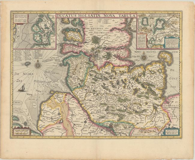
This decorative map depicts the Schwesig-Holstein region of present-day Germany, extending south to Hamburg. The inset at top left depicts the Halligen along the western coast, and the inset at right depicts several small lakes just south of Hollingstedt. The map is adorned with two compass roses and the North Sea is filled with depth soundings and a sailing ship. French text on verso.
References: Van der Krogt (Vol. I) #1660:1B.1.
Condition: A
A sharp, early impression with full contemporary color on a bright sheet with some creasing along the centerfold and light damp stains along the edges of the sheet, well away from the image.