Catalog Archive
Auction 182, Lot 503

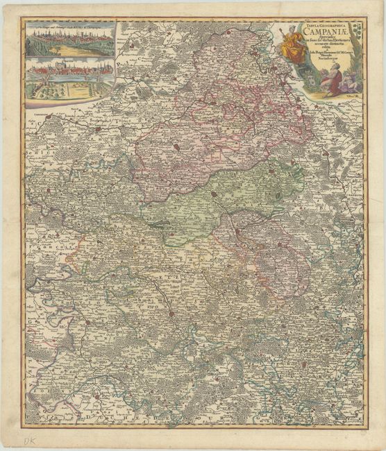
"Tabula Geographica Campaniae Specialis in suas sic Dictas Electiones Accurate Distincta", Homann, Johann Baptist
Subject: Northern France

Period: 1750 (circa)

Publication:

Color: Hand Color

Size:
19.4 x 22.9 inches
49.3 x 58.2 cm
Download High Resolution Image
(or just click on image to launch the Zoom viewer)

Beautifully detailed map of the Champagne region in France, showing the topography and towns of Compiegne, Menziere and Reims in the north to Sens, Troyes and Langres in the south. At upper left are two finely engraved bird's eye views of Troyes and Reims. The decorative cartouche features two satyrs imbibing in champagne.

References:

Condition: A

Beautiful example with a crisp, early impression and fine contemporary color int he map with later color in the cartouche and views. There is a printer's crease at top right and professional repairs to some separations along the centerfold, one small worm hole in the image, and a couple of minor edge tears.

Estimate: $190 - $220

Sold for: $140

Closed on 4/28/2021

Archived