Subject: Northern Ireland
Period: 1657 (circa)
Publication: Atlas Nuevo de los Reynos de Escosia e Yrlanda
Color: Hand Color
Size:
19.6 x 16.3 inches
49.8 x 41.4 cm
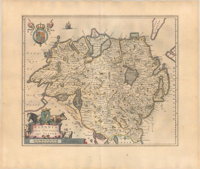
A lovely map of northern Ireland, adorned with a decorative title cartouche featuring livestock and coat of arms. The topography is shown pictorially with great detail of the rivers, lakes and mountains. Spanish text on verso, published between 1654-62.
Publication of Bleau’s atlas of Scotland and Ireland (Atlas Novus, Volume V) in 1654 was a landmark publication in cartographic history. Most of the maps were based on the surveys of Timothy Pont, which had been done half a century earlier. The publication took over seven decades to bring to publication; it was delayed by wars, copyright restrictions, and only intermittent official support. The maps are scarce today due to the relatively short publication history of the atlas.
References: Van der Krogt (Vol. I) #5940:2.
Condition: B+
A crisp impression with full contemporary color on a lightly toned sheet with a large Atlas watermark, marginal soiling, and a small hole in the bottom blank margin.