Subject: Scotland
Period: 1657 (circa)
Publication: Atlas Nuevo de los Reynos de Escosia e Yrlanda
Color: Hand Color
Size:
21.5 x 16.5 inches
54.6 x 41.9 cm
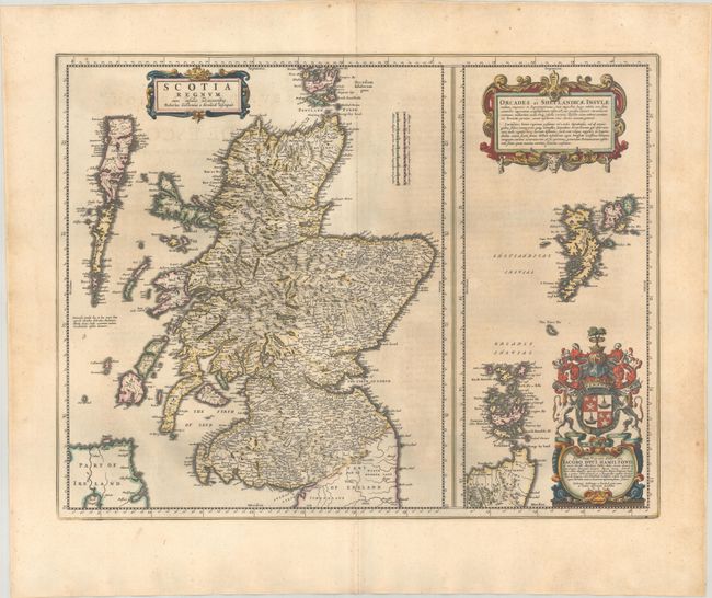
This fine map of Scotland with a large inset of the Orkney and Shetland Islands was published by Johannes Blaeu in the first atlas devoted to Scotland. The map is based on the surveys of Robert Gordon and includes numerous cartographic improvements over the previous standard map which was had been drawn more than sixty years earlier by Gerard Mercator. The map is finely engraved and richly embellished with three cartouches including one surmounted with the coat of arms of Jacob Hamilton, to which the map is dedicated. Spanish text on verso, published between 1654-62.
Publication of Bleau’s atlas of Scotland (Atlas Novus, Volume V) in 1654 was a landmark publication in cartographic history. Most of the maps were based on the surveys of Timothy Pont, which had been done half a century earlier. The publication took over seven decades to bring to publication; it was delayed by wars, copyright restrictions, and only intermittent official support. The maps are scarce today due to the relatively short publication history of the atlas.
References: Goss (Blaeu) pp.84-85; Van der Krogt (Vol. II) #5800:2B.
Condition: B+
A crisp impression with full contemporary color on a lightly toned sheet with a large Atlas watermark and marginal soiling.