Subject: London, England
Period: 1910 (circa)
Publication:
Color: Printed Color
Size:
34.4 x 23.4 inches
87.4 x 59.4 cm
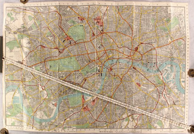
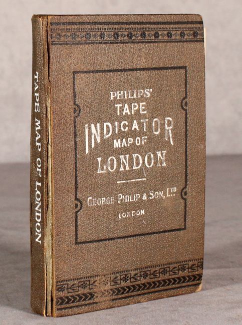
This novel pocket map includes a built-in cloth tape measure attached at left for measuring distances throughout the city in quarter mile segments. It spans from Kentish Town south to Clapham Common and from Wormwood Scrubs east to the Isle of Dogs. With the help of the in-depth street index, one can use the numbered tape measure and numbers on the map edge to navigate the city. Underground and electric railway routes are indicated in red, and bus and tram-car routes are shown in yellow. This example is linen-backed and folds into embossed green cloth covered boards with black decorative touches. The attached 72 pp. street index identifies churches, hotels, markets, monuments, museums, palaces, places of amusement, railway stations, theaters, and much more. Smith & Son published numerous editions of this map in the late 19th century; this example is a later edition published by George Philip & Son.
References:
Condition: B+
Map is in good condition with some fold separations and minor spots. Street index is starting to detach from boards. Covers have shelf wear with splits along the spine.