Subject: Northern South America
Period: 1703 (dated)
Publication:
Color: Hand Color
Size:
25.9 x 19.1 inches
65.8 x 48.5 cm
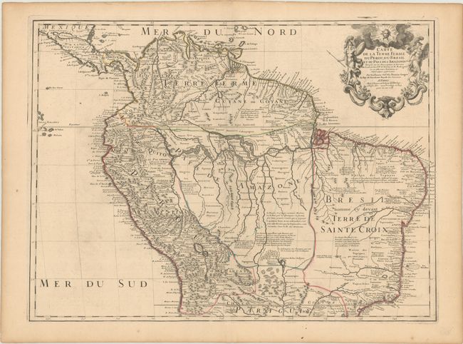
This handsome and important map of the northern part of South America is filled with information and notations speculating about the Indian tribes and the tributaries of the Amazon. The capitaineries are shown along the coast of Brazil. A notation in Guyana notes the mythical Lac de Parime on which the golden city of Manoa del Dorado was supposed to be located. The central part of the map, labeled Pays des Amazones, is filled with Indian names and notations. The Grand chemin des Ingas ( Inca Way) is shown from Chuquisaca in Peru to Pasto in Colombia. The title cartouche features mythical Amazon warriors, a pot of gold, and King Louis XIV, as the Sun King.
References:
Condition: B+
On a sheet with a watermark of a Maltese cross encircled in rosary beads. There is a small stain around the centerfold at top, minor offsetting and tiny wormholes that are only visible when held up to light.