Catalog Archive
Auction 182, Lot 400

"Guadaloupe, Done from Actual Surveys and Observations of the English, Whilst the Island Was in Their Possession, with Subsequent Improvements", Laurie, Richard Holmes
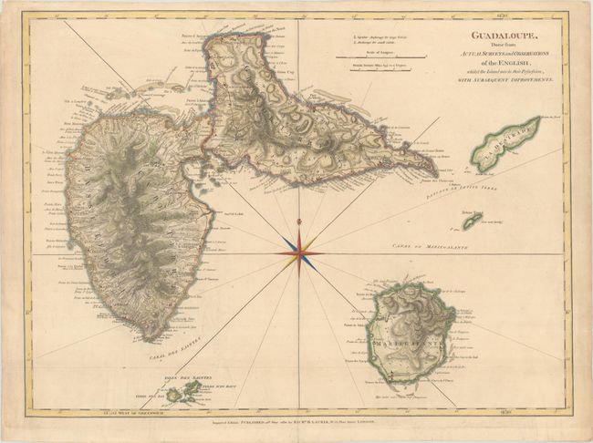
Subject: Guadeloupe

Period: 1830 (dated)

Publication:

Color: Hand Color

Size:
24.5 x 18.1 inches
62.2 x 46 cm
Download High Resolution Image
(or just click on image to launch the Zoom viewer)

A sharply engraved map with tremendous coastal detail showing dozens of rivers, towns, forts, churches, and military batteries. Interior detail is limited to the expertly rendered topography. A legend adjacent to the title identifies anchorages for both large and small vessels. The map depicts Basse-Terre, Grande-Terre, Marie-Galante, and the Iles des Saintes. This map was originally published by Jefferys in The West-India Atlas in 1775, with subsequent changes and improvements by Laurie & Whittle in 1795. For this edition, Laurie made further updates, most notably moving the island of La Desirade to the east of Grande-Terre, rather than to the north as in previous editions.

References:

Condition: A

A nice example, issued folding, with minor toning and soiling.

Estimate: $200 - $230

Sold for: $150

Closed on 4/28/2021

Archived