Subject: Eastern Hemisphere, World War I
Period: 1925 (dated)
Publication:
Color: Printed Color
Size:
9 x 10.7 inches
22.9 x 27.2 cm
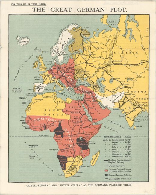
This fascinating World War I propaganda map depicts the German plot to conquer Central Europe, the Arabian Peninsula, and much of Africa. The map uses the color red to indicate the German Central Europe & Central Africa Scheme. The key at right identifies the distances between Berlin and various cities, railways, and former German colonies. According to the text by the Earl of Denbigh on verso, "Since 1870 the Prussian spirit of arrogance, ambition, cunning and ruthlessness has gradually permeated through Germany. Germans more and more aimed at World Dominion. 'Weltmacht oder Niedergang' ('World Dominion or Downfall') became a favorite motto." This is a later edition of the map published after the war by Roberts & Leete, Limited, London. It is based on a map that originally appeared in Andre Cheradanie's The German Plot Unmasked that was later enlarged and reproduced by R. Clay & Sons in 1918.
References:
Condition: A
Issued folding with a short fold separation confined to the top left blank margin that has been closed on verso with archival tissue.