Subject: Southwestern United States & Mexico
Period: 1810 (dated)
Publication:
Color: Black & White
Size:
11.4 x 16.4 inches
29 x 41.7 cm
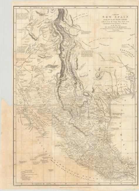
This is a reduced version of Humboldt's landmark map of the American Southwest and Mexico that was issued in an English edition of his Essai Politique Sur le Royaume de la Nouvelle-Espagne. Wheat describes the large map as undoubtedly the most important and accurate published map that had yet appeared (as of its publication date). Humboldt's map would remain the standard source until Fremont's mapping of the area in the 1840s. In addition to the map's superior accuracy, it is notable for introducing the concept of hachuring (orthographic projection) to convey topography. However, despite these improvements and innovations, Humboldt's map still contains a few errors including a depiction of the mythical Lake Timpanogos, along with several notes concerning its sources. Humboldt himself acknowledges the incomplete information and that "it must be allowed that all that part of the west of North America is still but very imperfectly known." Dated 1810 in the imprint at bottom and published in 1811.
References: cf. Wheat (TMW) #272; Howes #H-786.
Condition: B
Issued folding with light scattered foxing. There is a short binding tear at left that just enters the border and a 4" separation along the lower left fold that have both been closed on verso with archival tape.