Subject: Southwestern United States & Mexico
Period: 1765 (dated)
Publication: Hedendaagsche Historie of Tegenwoordige Staat van Amerika
Color: Hand Color
Size:
13.9 x 12.9 inches
35.3 x 32.8 cm
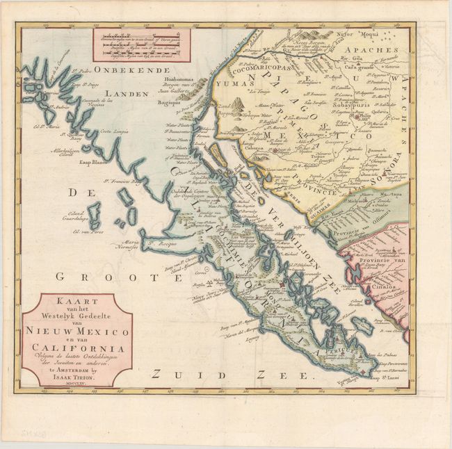
This bold map of Baja California and the American Southwest reflects the explorations of the Jesuits including Father Kino. Place names in today's southern Arizona include Casa Grande, the Gila River, and San Xavier de Bac. Along the Pacific are the cities of San Diego, Ensenada, and Cabo San Lucas. Numerous, oversized islands are shown along both coasts of the Baja Peninsula. Missions are pictorially identified throughout the map and there are two fortifications in Baja at San Jose del Cabo and Loretto. The map was originally published in Tirion's Nieuwe en Beknopte Hand Atlas; this folding example was published in Hedendaagsche Historie of Tegenwoordige Staat van Amerika (1766), Tirion's translation of part of Salmon's Modern History.
References: Lowery #498; Wagner #608; Wheat [TMW] #148.
Condition: A
A crisp impression issued folding with minor offsetting and some extraneous creasing in the top blank margin.