Subject: United States & Mexico
Period: 1846 (circa)
Publication:
Color: Hand Color
Size:
22.3 x 17.7 inches
56.6 x 45 cm
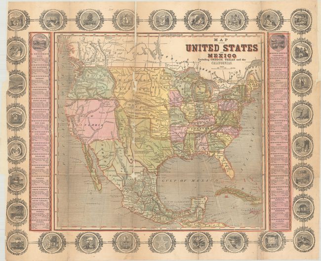
This scarce ornamental map depicts the United States and Mexico during the Mexican-American War. It shows a small New Mexico Territory situated between the new state of Texas and the disputed area of New California. There is a red line following the Platte, Snake and Columbia Rivers labeled the "Route of Oregon Immigrants" as well as a "Route to the United States" stretching from San Francisco to the Sweetwater River. The map is surrounded by an ornamental border including 30 state seals with two columns of statistical information flanking the map. The last dated state is 1846 (Iowa). A similar map measuring 15.3 x 10.5" is noted in Wheat (#514), containing a large text panel below the image discussing the Seat of War.
References: Wheat (TMW) #513; cf. Wheat (Gold) #26.
Condition: C+
Issued folding and now flattened and backed with tissue to reinforce and repair a couple of long separations with several small areas of loss along the same fold. The sheet has been trimmed slightly into the left decorative border along with a small chip.