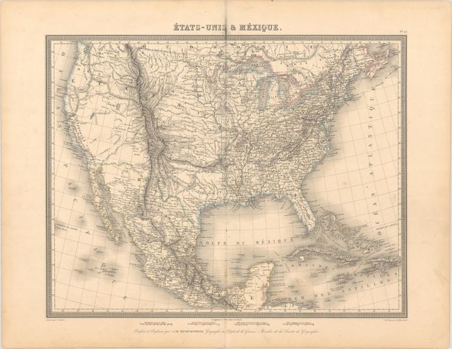
Subject: United States & Mexico, Texas
Period: 1842 (circa)
Publication: Atlas Universel...
Color: Hand Color
Size:
16.7 x 13.1 inches
42.4 x 33.3 cm
A beautifully engraved and detailed map showing the United States possessions prior to the Mexican-American War. The region between the Mississippi River and Continental Divide is filled with Indian Districts and an ambiguous Oregon Territory extends north into Canada. The Republic of Texas is shown in an unusual small configuration with New Mexico and Indians lands occupying the panhandle. The Great Basin includes the S. Buenaventura R. running a supposed course to the San Francisco Bay and Nouvelle California is located along the coast. There is excellent detail throughout including Indian names, watersheds, railroads, forts, roads, and more. Surrounded by a decorative keyboard-style border.
References: Phillips (Atlases) #786-25.
Condition: B+
A crisp impression with some minor foxing and soiling along the centerfold. A short centerfold separation confined to the bottom blank margin has been closed on verso with archival tape.