Subject: Utah
Period: 1858 (dated)
Publication: Sen. Ex. Doc. 40, 35th Congress, 2nd Session
Color: Black & White
Size:
44.1 x 30 inches
112 x 76.2 cm
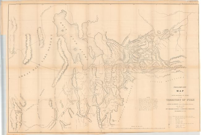
This large, accurate and carefully drawn map details the portion of Utah from the Great Salt Lake Desert to Fort Bridger, to above the Great Salt Lake and south to below Goshen and Mt. Nebo. Issued shortly after the Utah War the map contains terrific detail of wagon roads, trails, military camps, early settlements and several Mormon Fortifications. These fortifications were built by Mormon settlers in defense against the U.S. Army’s Utah Expedition, to which Captain James H. Simpson was assigned. The map documents Simpson’s important reconnaissance to find an alternate wagon road through Nevada and Utah to California. Simpson’s Central Overland Trail, as it was known, became a vital transportation route, most notably used by the Pony Express and later the Transcontinental Telegraph. This route was nearly 300 miles shorter than the California Trail that followed the Humboldt River. The map also shows the previous routes of Stansbury and Beckwith.
References: Wheat (TMW) #998.
Condition: B
Issued folding with a number of short splits at the fold junctions and a small binding tear confined to the top left blank margin. The map has been trimmed to just inside the border at bottom right.