Subject: Texas
Period: 1882-88 (circa)
Publication:
Color: Hand Color
This lot includes four Texas maps from the 1880's, all with hand-coloring which is unusual for this time in commercial cartography as most publisher had shifted to more cost effective printed color:
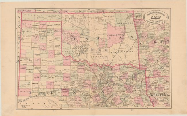
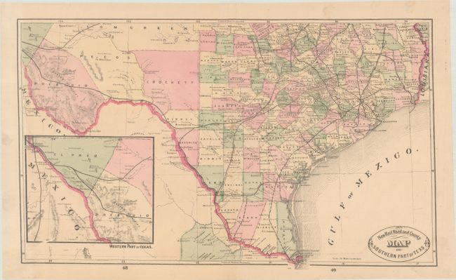
A. [Lot of 2] New Rail Road and County Map of Indian Territory, and Northern Part Of Texas (17.8 x 11.5") and New Rail Road and County Map of Southern Part of Texas (19.6 x 11.9"),
by George F. Cram & Company, circa 1882. These two maps together present all of Texas, Indian Territory, and the Public Lands in the panhandle. Shows the large counties of Tom Green, Crockett, Pecos, Presidio, and El Paso in the west. Filled with details including completed and proposed railroads, towns and villages, forts, county divisions, and more. Shows the forts of Leaton, Lancaster, Ewell, plus Camp Hudson, and Waugh’s Ranch in LaSalle County. Other interesting place names include Gallagher’s Ranch in Medina County, Spencer’s Rancho, Hard’s Pass, Wild Rose Pass, Dead Man’s Pass, the Frico Water Hole in Bandera County, and Perry’s Landing, where slaves were traded in the antebellum era. Condition: There is minor soiling and foxing. A small hole in the northern map has been backed with archival tape on verso. (B+)
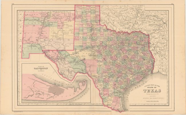
B. County Map of the State of Texas Showing Also Portions of the Adjoining States and Territories, by William M. Bradley & Bros., dated 1887 (21.3 x 14.4"). This attractive, double-page map of Texas extends to include most of New Mexico to above Santa Fe and the adjoining parts of Oklahoma, Arkansas and Louisiana. The map presents an excellent view of county development with only the large regions of West Texas yet to be fully organized. Galveston’s role as a main port of entry is obvious as it is depicted in a large inset. The Llano Estacado, or Staked Plain, is shown extending from the New Mexico Territory through the Texas panhandle. Condition: Light scattered foxing that is mostly in the margins. (B+)
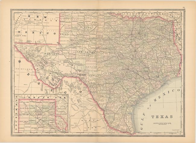
C. Texas, by George F. Cram & Company , circa 1888 (22.3 x 16.4"). An attractive and detailed map of the state with most of western Texas broken into smaller counties. Presents good detail of the railroad network extending to El Paso. Includes an inset of the panhandle at bottom left and surrounded by Cram's decorative border. Condition: There is a hint of toning along the sheet edges, otherwise fine. (A)
References:
Condition:
See description above.