Subject: Texas & Oklahoma
Period: 1883 (circa)
Publication:
Color: Printed Color
Size:
19.2 x 24.7 inches
48.8 x 62.7 cm
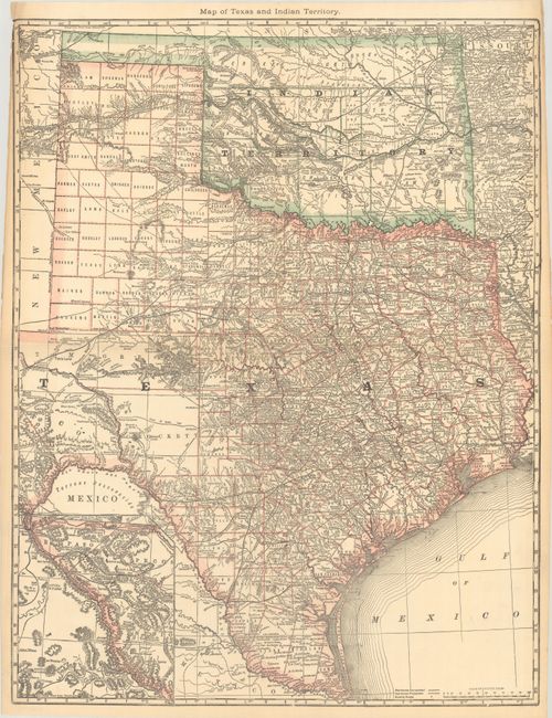
A very detailed map of Texas and Indian territory with an inset map of west Texas on the same scale. Shows good detail of roads, completed railroads, and projected railroads. Tom Green County is shown in a large, early configuration, not yet divided into Sterling, Irion, Coke, and Midland. In Greer County in southwestern Indian Territory two boundaries are shown: “Boundary Claimed by the State of Texas,” and “Boundary Claimed by the United States.” The dispute was ultimately decided by the Supreme Court which accepted the United States boundary and Greer County became part of the Indian Territory. From the 1883 edition of Hardesty’s atlas, before the Texas map was reduced in size.
References:
Condition: B+
A clean copy with the side margin trimmed at top left and a couple of tiny chips in the border. Issued folding with a tiny split at the center fold junction.