Subject: Oklahoma
Period: 1939 (dated)
Publication:
Color: Black & White
Size:
23.6 x 12.5 inches
59.9 x 31.8 cm
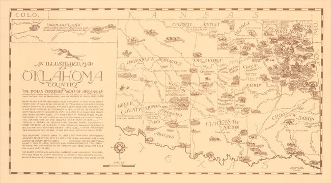
This pictorial map of Oklahoma was issued by Vinson Lackey in Tulsa, and covers the period from "its formation to the opening of its several red men's nations and reservations for the purpose of white settlement." It delineates the lands of the various Indian Nations along with Greer County along the Red River, the Cherokee Strip, and the Public Lands of the panhandle here named "No-Mans-Land." The map is filled with small illustrations reflective of the region's history including forts, trading posts, Indian agencies, missions, and more. Completed by a decorative compass rose and scale of miles.
References:
Condition: A
On a clean watermarked sheet with a few tiny edge tears confined to the bottom blank margin, far from the map image.