Subject: Oklahoma
Period: 1880-87 (dated)
Publication:
Color: Hand Color
Two maps of Indian Territory over a 7 year period:
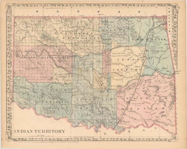
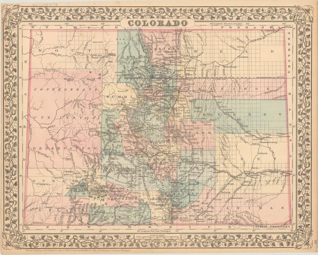
A. Indian Territory, by Samuel Augustus Mitchell, dated 1880 (14.5 x 11.4"). A detailed map of the territory showing the numerous Indian Nations but not the Public Lands of the panhandle. It is filled with information on towns and villages, railroads, forts, military reservations, and more. Treaty dates accompany the land holdings of each Indian Nation. The verso contains a detailed map of Colorado.
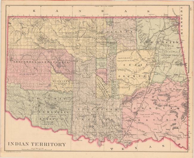
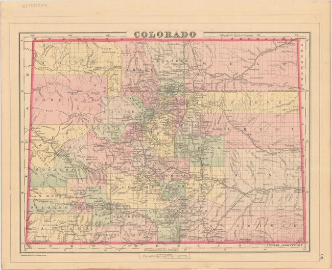
B. Indian Territory, by William M. Bradley & Bros., dated 1887 (14.9 x 11.7"). This updated version shows additional towns and reservations. The Cheyennes and Arapahoes no longer are shown in the Cherokee Outlet, but the Nez Perce, Poncas and Otoes are included with ill-defined boundaries. The Iowa and Kickapoo reservations have been added with discrete boundaries at the center of the territory. Verso also contains a map of Colorado.
References:
Condition: B+
There is a hint of toning and some minor foxing.