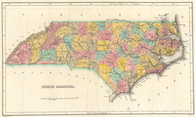
Subject: North Carolina
Period: 1822 (circa)
Publication: A Complete Historical, Chronological, and Geographical American Atlas...
Color: Hand Color
Size:
18.6 x 10.8 inches
47.2 x 27.4 cm
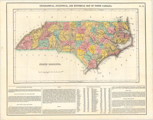
This map is on a full folio sheet (20.6 x 16.6") with English text below giving a brief description of the state’s boundaries, soil, watershed, climate, population, chief towns, internal improvements, and the "natural curiosity" of Ararat or Pilot Mountain. The map delineates 62 counties, with the county configuration current to 1821. For some reason the shared border between Georgia and North Carolina is omitted. According to the figures below the map, the state's total population in 1820 was 638,829: "Of these there are free white males, 209,644; free white females, 209,556. The free coloured population amounts to 14,612; and there are 205,017 slaves." Drawn by Field Lucas Jr. and engraved by Kneass.
References: Williams & Johnson #19A.
Condition: B+
On a bright sheet that has been backed with tissue to repair a short centerfold separation and edge tear at bottom.