Catalog Archive
Auction 182, Lot 286

"Geological Map of Isle Royale Lake Superior, Michigan", Foster/Whitney

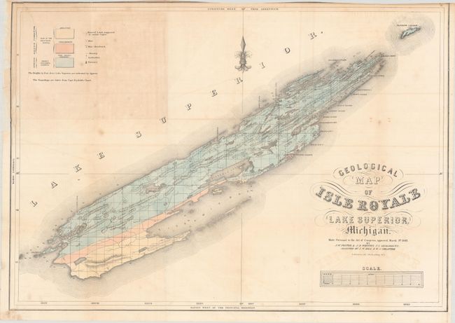
Subject: Lake Superior, Michigan

Period: 1847 (dated)

Publication: Report on the Geology and Topography...Lake Superior Land District

Color: Hand Color

Size:
24.8 x 17.5 inches
63 x 44.5 cm
Download High Resolution Image
(or just click on image to launch the Zoom viewer)

This early geological map updates Charles T. Jackson's map of 1847 and was completed after J.W. Foster and J.D. Whitney took over the Survey of the Mineral Lands of Michigan in 1850. It locates Sandstone, Conglomerate and "Trap: Basalt, Porphyry" with three different colors. Legend keys Mines, Abandoned Mines, Mineral Land Supposed to Contain Copper, Furnace, and more.

References: Karpinski (MI) #764; Marcou & Marcou #365.

Condition: B

Issued folding with light offsetting, minor foxing, and trimmed to the border at top. A 6" tear and some edge chips at top left have been archivally repaired on verso.

Estimate: $100 - $130

Sold for: $60

Closed on 4/28/2021

Archived