Subject: Miami, Florida
Period: 1939-62 (dated)
Publication:
Color: Printed Color
Two maps of Miami by Carmel Wilson including:
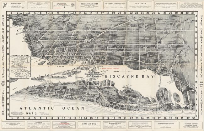
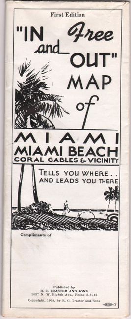
A. “In and Out” Map of Miami Miami Beach Coral Gables & Vicinity, dated 1939 (26.4 x 15.1"). This first-edition brochure folds out to a large bird's-eye view of Miami and Miami Beach with numerous buildings and landmarks illustrated and identified. Includes a small inset showing "Distances to Miami." The map is surrounded by local advertisements and the verso has an extensive index of apartments, hotels, dining, and more. Drawn by Carmel Wilson and published by R.C. Traster & Sons. Condition: Issued folding on a mostly clean bright sheet. There are several fold separations along the horizontal fold with minute loss at the junctions. (B+)
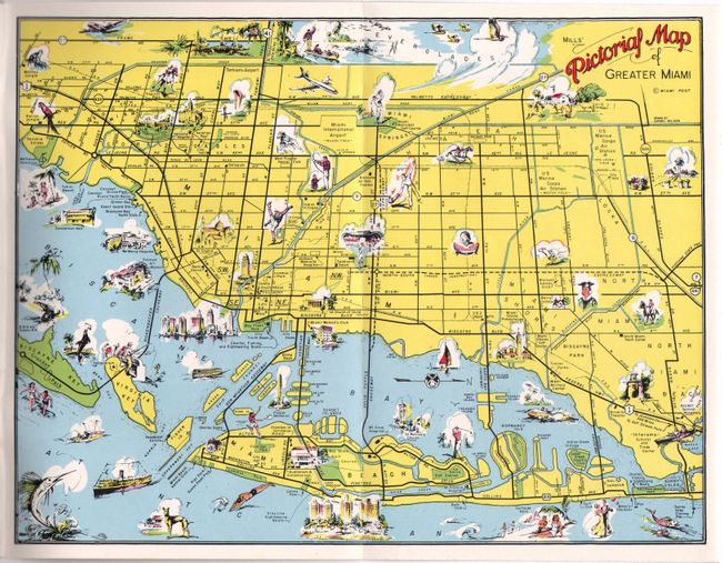
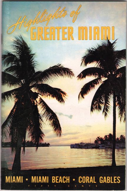
B. Mills’ Pictorial Map of Greater Miami [in] Highlights of Greater Miami, published 1962 (10.4 x 7.9"). This 96-page advertising pamphlet is filled with "outstanding photography and authentic information...unlocking for you the warmth, the beauty, excitement and vitality that makes Miami one of America's truly enchanting vacationlands." Includes stereotypical articles on "South Florida's Colorful Seminole Indians" and "Black Caesar," a slave who escaped from a shipwreck, and “naturally consumed by an intense hatred of all whites, …turned pirate…butchering and murdering crews… (p. 27).” The rear cover contains a small folding pictorial map of Miami and vicinity that is filled with illustrations of interest to the tourist including fishing, swimming, beaches, jai alai and more. Seventeenth edition. Condition: Clean and bright. (A)
References:
Condition:
See description above.