Subject: Arizona & New Mexico
Period: 1874-87 (dated)
Publication:
Color: Hand Color
The Southwest region was acquired by the United States at the end of the Mexican-America War in 1848 and became New Mexico Territory in 1850. Early attempts to gain statehood were quashed by the debates over slavery. During the Civil War, the original New Mexico Territory was split with the western part becoming the Arizona Territory. The Desert Land Act of 1877, which encouraged economic development in the Western states, resulted in a flood of new settlement into the territories. The maps in this lot provide an excellent view of the early development of these territories.
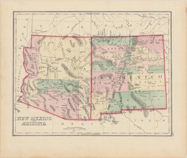
A. New Mexico and Arizona, by O.W. Gray, from The Atlas of the United States, dated 1874 (14.7 x 11.5"). This attractive map was issued a decade after the separation of the region into the territories of New Mexico and Arizona. There are only six counties in Arizona, and Tucson is shown as the capital. The map shows villages, the major mining towns, many forts, and a few railroads. On verso is a nice map of Mexico with insets of the Isthmus of Tehuantepec and the railways between Vera Cruz and Mexico City. Condition: Minor soiling. (A)
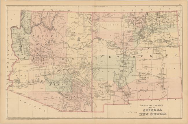
B. County and Township Map of Arizona and New Mexico, by Samuel Augustus Mitchell, from Mitchell’s New General Atlas, dated 1882 (21.8 x 13.9"). This large and detailed map of the territories contains excellent detail of mountains, roads, villages and towns, railroads, and the extent of completed surveys. The Navajo Reservation has been established, overlapping the territorial boundary in the north. Condition: On a lightly toned sheet with centerfold separations at top and bottom that have been closed on verso with archival tape. (B+)
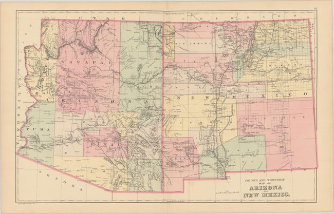
C. County and Township Map of Arizona and New Mexico, by Samuel Augustus Mitchell/William M. Bradley & Bros., from Mitchell’s New General Atlas, dated 1887 (21.9 x 13.9"). Nearly identical to the map immediately above, this was issued shortly after Bradley obtained Mitchell’s atlas. But close examination reveals considerable growth in just five years. There are new counties in both territories, and the General Land Office has been busy completing new surveys. Condition: There is a small area of minor foxing and a centerfold separation in the bottom margin that has been closed with archival tape on verso. (A)
References:
Condition:
See description above.