Subject: Western United States
Period: 1947-61 (dated)
Publication:
Color: Printed Color
Two pictorial maps published by the American Pioneer Trails Association:
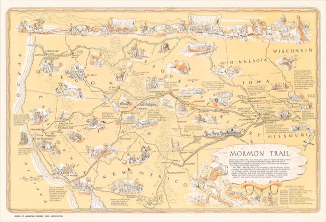
A. Mormon Trail, dated 1947 (29.0 x 19.1"). This attractive pictorial map of the Mormon Trail was created by J. Rulon Hales. It prominently depicts the route from Nauvoo, Illinois to Salt Lake City in orange, with several other trails drawn on the map including the Santa Fe, Oregon, Old Spanish, and Lewis & Clark trails. Descriptive text and numerous illustrations complete the composition, with a large depiction of a wagon train at top. Surrounded by a decorative rope border.
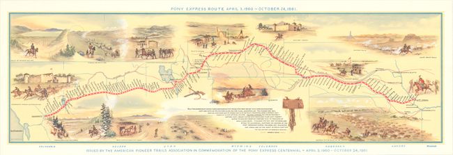
B. Pony Express Route April 3, 1860 - October 24, 1861, dated 1961 (28.7 x 8.6"). This vivid pictorial map depicts the Pony Express Route from St. Joseph, Missouri to Sacramento, California. The map identifies the many stops along the route where riders would rest and refuel and is illustrated with small vignettes including Old Fort Laramie, Sweetwater Station, the Valley of the Great Salt Lake and the Relay Station near Utah Desert. Below the map image reads "Issued by the American Pioneer Trails Association in Commemoration of the Pony Express Centennial."
References:
Condition: A+
Both examples are clean, bright and fine.