Subject: Dakota Territory
Period: 1873-84 (dated)
Publication:
Color: Hand Color
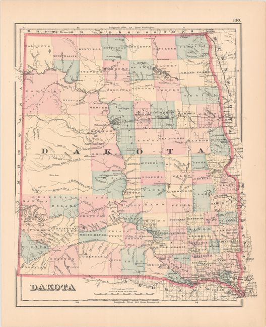
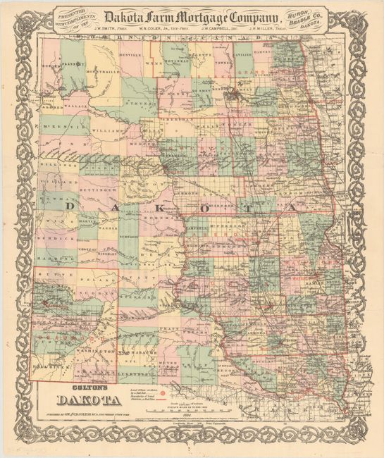
This attractive pair of maps covers an 11-year period when the territory's population grew by a tenfold factor. The exponential growth was attributed to the construction of the Northern Pacific Railroad along with the discovery of gold in what was to become the Deadwood District. The 1873 atlas map shows a large unnamed region in the west, many oversized counties, and the railroad only reaching the Missouri River. The 1884 map designed for the "Dakota Farm Mortgage Company" shows the newly created land districts in red overprinting. Most notable is the Deadwood District in the Southwest corner, the only land district west of the Missouri River. The Indian reservations located on the 1873 map in this region are gone on the 1884 map and the town of Deadwood sits prominently at the terminus of a railroad from the east. A fascinating pair of maps worthy of further research.
A. Dakota, dated 1873 (12.6 x 14.8"). Condition: Fine. (A+)
B. Colton's Dakota, dated 1884 (13.2 x 16.0"). Condition: Issued folding and now flat with a few minor fold separations along the sheet edges that have been closed on verso with archival tape. There are remnants of the original paper wrapper on verso. (A)
References:
Condition:
See description above.