Subject: South Central United States
Period: 1843-81 (circa)
Publication:
Color: Hand Color
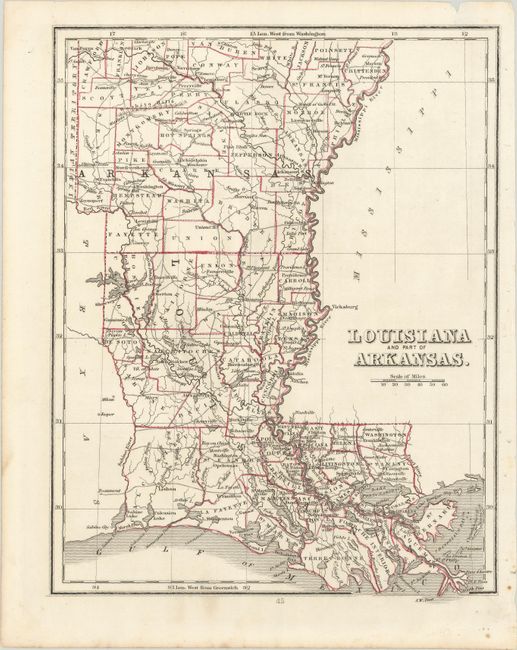
A. Louisiana and Part of Arkansas, by Bradford & Goodrich, circa 1843 (7.8 x 10.1"). A simple but attractive map delineated by parish/county. It shows good detail along the coast including marshes and bays, and depicts numerous towns and settlements. In addition to early county configuration, the map provides great detail of the network of roads serving the region. Condition: There are some small spots and binding holes confined to the right blank margin. (A)
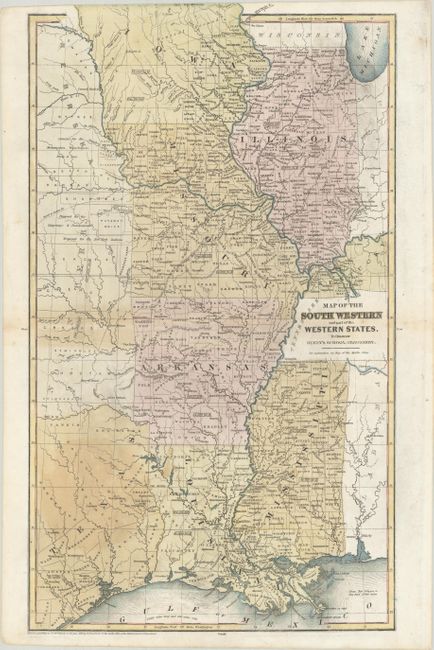
B. Map of the South Western and Part of the Western States. To Illustrate Olney's School Geography, by Jesse Olney, from Olney’s School Geography, dated 1844 (10.4 x 17.7"). Despite the title, this map covers the southern part of the Central United States including Illinois, Missouri, Arkansas, Mississippi, and Louisiana with parts of Indiana, Kentucky, Alabama, Nebraska, Indian Territory, and Texas. Much of northern Iowa is labeled as “Neutral Ground” referring to Winnebago reservation intended to protect the tribe from the Sioux, Sac, and Fox tribes. In Texas, the elusive Spring Creek County appears (although it only existed between 1841 and 1842). There are several interesting notations concerning tribal lands in Indian Territory. Published by D.F.Robinson. Condition: There are some light stains and soiling and a short hole along the centerfold. (B+)
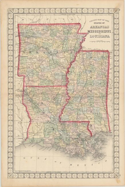
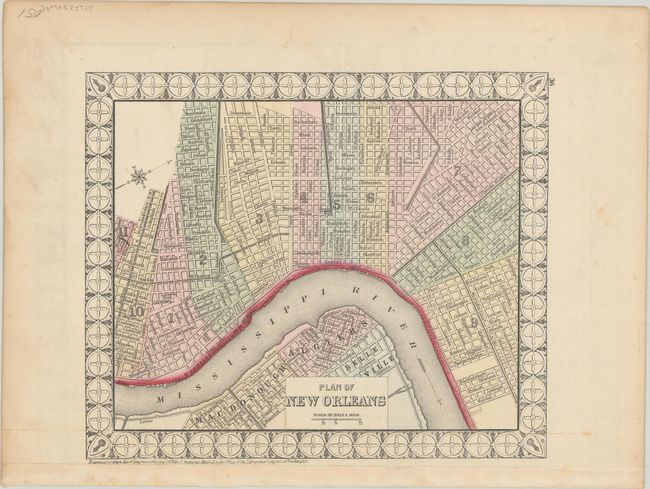
C. County Map of the States of Arkansas Mississippi and Louisiana, by Samuel Augustus Mitchell/William H.Gamble, dated 1874 (13.8 x 20.9"). This is a very unusual example of Mitchell’s map of these southern states. It is surrounded by a decorative border with an atypical design for a Mitchell map. Drawn and engraved by Gamble. A map of New Orleans is on verso, also surrounded by the unusual border. Condition: Contemporary color with minor scattered foxing and some light soiling at right that enters the borders at top and bottom. (B+)
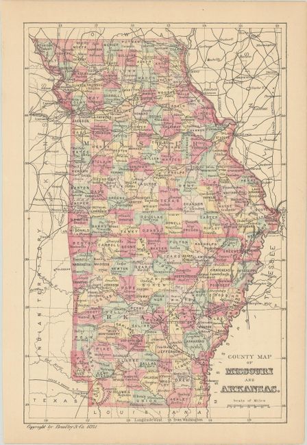
D. County Map of Missouri and Arkansas, by Bradley & Co., dated 1881 (5.6 x 8.5"). A handsome little map colored by county and showing the expanding railroad network. Condition: Contemporary color with a hint of toning. (A)
References:
Condition:
See description above.