Subject: North America
Period: 1809 (dated)
Publication:
Color: Hand Color
Size:
17.1 x 14.4 inches
43.4 x 36.6 cm
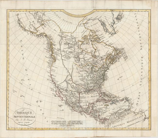
This attractive map shows the United States boundary extending to the Rocky Mountains with the inclusion of the recently acquired Louisiane. The Southwest is under Spanish control, and the interior of the West is void of detail. The supposed course of the Columbia River is shown flowing into British Columbia, and a possible Northwest Passage is shown through a series of rivers and lakes between Hudson Bay and the Pacific Ocean. The map extends from the eastern tip of Asia and the Bering Strait to northern South America and the Caribbean islands. Decorated by a title cartouche with fancy titling and five distance scales.
References:
Condition: B+
Issued folding on watermarked paper with light offsetting and a few spots of foxing. Remargined at right with a small portion of border in facsimile.